 Featured
OilPalmVision.ai : Automating Oil Palm Census
About this Project
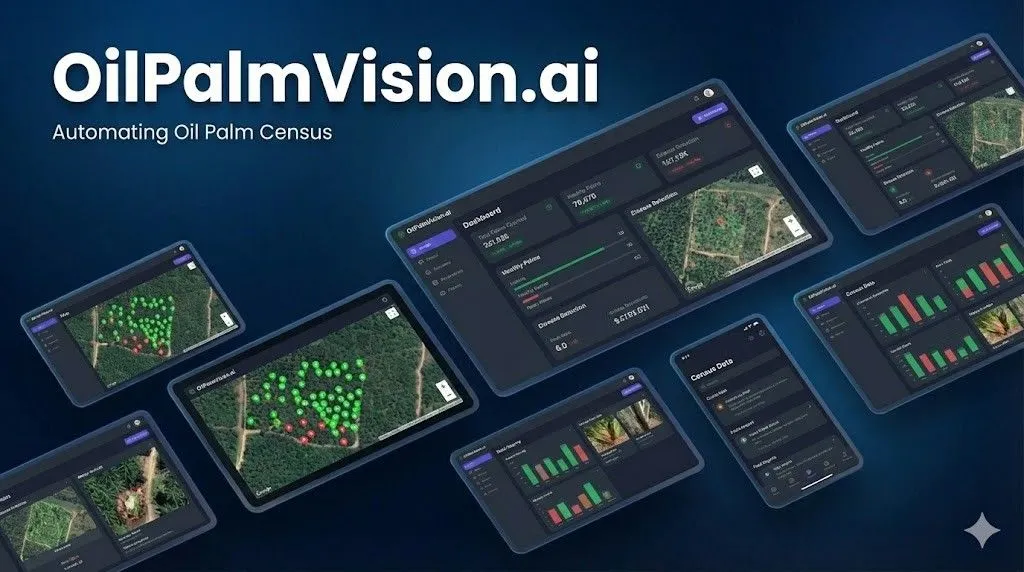
OilPalmVision is an AI SaaS platform designed to automate oil palm tree census and Management. By leveraging YOLOv8 computer vision and geospatial processing, it transforms drone and satellite imagery into actionable plantation insights, including precise tree counts, GPS coordinates, and Stand Per Hectare (SPH) metrics
Details
OilPalmVision is a comprehensive solution for modern plantation management, bridging the gap between high-resolution aerial imagery and digital inventory. The platform is built to handle the complexities of large-scale agriculture by providing an automated, scalable pipeline for tree identification and spatial analysis.
Key Technical Capabilities:
• Advanced AI Detection: Utilizing the YOLOv8 model and PyTorch, the system performs high-speed object detection to identify individual palm trees even in dense canopies.
• Geospatial Intelligence: The platform supports GeoTIFF imagery and automatically converts image pixel coordinates into precise WGS84 GPS coordinates using affine transformation.
• Massive Data Handling: It is engineered to process large imagery files (up to 2GB) through an intelligent automatic tiling system that breaks down massive orthomosaics into manageable segments for the AI.
• Scalable Architecture: Built with a high-performance backend using FastAPI, PostgreSQL/PostGIS, and Redis Queue (RQ), the system processes detection tasks asynchronously in the background, ensuring a smooth user experience even during intensive computations.
• Interactive Visualization & Export: Users can visualize results on interactive React Leaflet maps with confidence-coded markers. For further GIS analysis, data can be exported in GeoJSON or CSV formats, compatible with industry-standard software like QGIS and ArcGIS.
Performance & Efficiency: The system is optimized for speed, capable of processing a 10-hectare plantation (approx. 4000x4000px) in roughly 45 seconds when using GPU acceleration. This drastically reduces the time and manual labor typically required for traditional ground-based or manual photo-counting census methods